|
Google
map of County Armagh
|
|
| |
| Armagh
Free E-Cards Armagh is the smallest of the six counties of Armagh is one of the richest agricultural areas of Ireland, and was formerly one of the most densely populated. This is explained partly by its fertility, and partly by the intensive farming methods introduced in the 1600's. Mixed fruit cultivation is a major industry, the county is often referred to as the Orchard County of Ireland. Read about farming practices in County Armagh from Samuel Lewis' Topographical Directory of Ireland published in 1837.
|
||||
|
|
| Lurgan and Portadown are industrial towns that owe their importance largely to the linen industry, which is now in decline. Keady, Markethill, Newtownhamilton, and Crossmaglen are small market towns with some light industry. Richhill and Loughgall are market Centre's for apples and strawberries. Armagh, the former county town, is now the administrative seat of the district. It manufactures textiles, chemicals, optical equipment, and processed foods. In the mid 70's an experiment was embarked upon to build a new city Craigavon based on the towns of Lurgan and Portadown. Thousands of acres were compulsorily purchased. New road systems and housing estates were built and cash incentive schemes were introduced to encourage people to settle in the area, this was only partly successful as a lot of people came collected their cash and left and in many cases leaving the new houses devoid of their plumbing and fittings. The Goodyear tire and rubber company built a large factory which was in operation for several years It is said that when its incentive schemes expired they too found it more expedient to move on. |
||
|
|
| Armagh
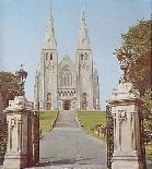
got its name which means (Macha's Height) In the 5th century St Patrick built the first of his two churches in Armagh at a place he called 'my sweet hill' It grew to be the ecclesiastical Capital of Ireland The orchard county of Ireland, apples were once
a very large industry, there still are extensive orchards, but their financial
contribution to the economy is not as great as it once was. Many of the
17th-century settlers here came from Worcestershire and laid out the orchards
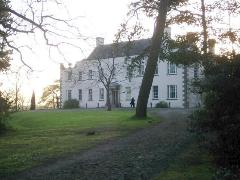
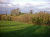
on the same pattern as those in the Vale of Evesham. You will find images of County Armagh on this page. Read about County Armagh from Lewis' Topographical Survey of Ireland 1837. |
||
|
|
 |
||||||
|
|
Google
Map of County Armagh. |
||
|
|
||
|
|
|
Beauty
| Bridal |
Eat Out | Equestrian
| Estate Agents | Events
| Fishing | Florists
| Golf | Guest
| Hotels | Jewelers
| Building Contractors Motor
Factors | Tyres
Museums | Music | Photographers | Self Catering | Taxi | Travel Agents | Vintage | Wedding Transport | Co Armagh in 1837 |

 Northern
Ireland. It extends from the shore of Lough Neagh in the north to the
border with the Republic of Ireland in the south and west. It is bounded
by County Tyrone to the west and County Down to the east. Since the reorganization
of local government in 1973, much of the county has formed the district
of Armagh. Other parts have been included in the districts of Dungannon,
Banbridge, and Newry and Mourne.